|
|
Post by ilmatto on Apr 13, 2010 23:54:30 GMT -5
|
|
|
|
Post by caucasoididiot on Apr 14, 2010 8:40:17 GMT -5
You have a nicely scenic yard, friendly. One vast improvement of my California house over Japan is a nice yard screened by trees, but I can't claim a forest.
Ilmatto, is that Santa during the off-season?
|
|
|
|
Post by ilmatto on Apr 14, 2010 9:12:18 GMT -5
Ilmatto, is that Santa during the off-season? No I liked friendly's tropical locale so I wanted to post an opposing viewpoint. |
|
|
|
Post by spackle on Apr 14, 2010 9:22:05 GMT -5
Or, you could live here. 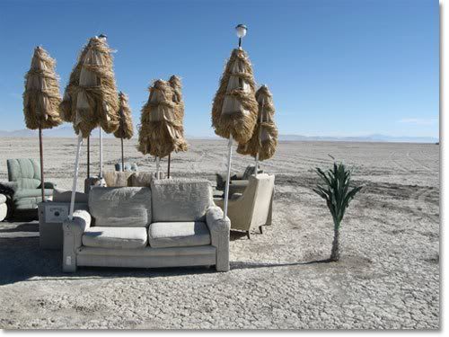 |
|
|
|
Post by afriendlychicken on Apr 14, 2010 17:36:41 GMT -5
I'm waiting for a swamp picture...anyone?
|
|
|
|
Post by ilmatto on Apr 14, 2010 18:14:23 GMT -5
I think spackle provided the true opposing viewpoint.
The only drawback to living at AFC's location is: if you put off mowing your grass for a week, you can't find your house. The location reminds me a lot of Okinawa. Anywhere that wasn't actually mowed or paved was soaring vegetation; lots of rain and volcanic soil.
|
|
|
|
Post by afriendlychicken on Apr 15, 2010 6:18:12 GMT -5
Sometimes you can't mow for weeks, and then you have to wait for the ground to dry a little. I was looking through youtube when I discovered a few great videos on our February 27th, tsunami warning. I cannot imagine what the people of Chile went through. This first video was taken by the Uh-Hilo Center for the Study of Active Volcanoes. It takes you through that whole day and a few of the tidal surges are shown. You'll notice that Hilo was having a very clear and sunny day. 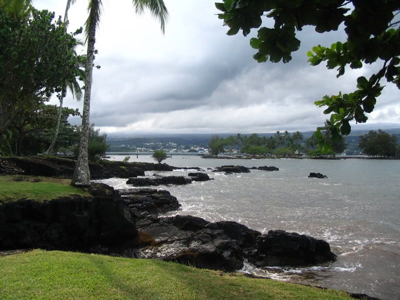 Hilo bay looking towards Coconut Island. In this next video, you get the best shots I've found of the tidal surges that were happening. The only problem with it is the people in the video were very stupid. They would have died if an actual large wave came. Huh, tourist...  This next one is a continuation of the previous video, It shows a large surge up the Wailuku River  The Wailuku river. This short clip is of the news coverage from that day. It shows a very nice image of Hilo Bay's tidal fluctuations. Lastly, Our Mayor, Billy Kenoi, tells his story about that day. Some more footage of Hilo. That's a view of Mauna Kea in the beginning. 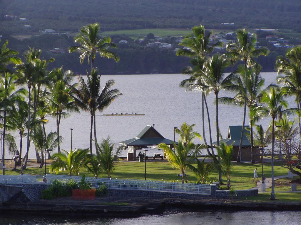 A close up view of Coconut island. I'm becoming the master of linking. Am I doing something wrong that I can't seem to embed these videos? Well anyway. I hope you enjoyed them. Aloha. |
|
|
|
Post by spackle on Apr 15, 2010 8:14:41 GMT -5
Interesting videos. I remember what you said earlier about Hilo Bay being like a toilet that flushed a few times. Quite an image!
I'm going to refrain from posting a swamp pic... you live in such a beautiful place!!!!!
|
|
|
|
Post by caucasoididiot on Apr 15, 2010 8:27:42 GMT -5
I heartily second that sentiment.
Friendly, I've had trouble embedding YouTubes a time or two. I gather the poster can disable that ability.
What other potential disasters is your region subject to? I remember seeing footage over the years of people's house being engulfed in lava flows and such. My particular stretch of California is one of its least earthquake prone, but some of that footage reminded me of the floods we get every few years.
|
|
|
|
Post by afriendlychicken on Apr 15, 2010 20:23:17 GMT -5
What other potential disasters is your region subject to? I remember seeing footage over the years of people's house being engulfed in lava flows and such. My particular stretch of California is one of its least earthquake prone, but some of that footage reminded me of the floods we get every few years. We have just about everything. Hurricanes, tropical storms and tropical depressions, and the flooding and wind destruction that comes from it. Tornado's. Yes, we have had tornadoes. They are usually over the ocean as water spouts, but occasionally they happen on land. Blizzard's, on the top of the mountains. Tsunami's, volcanic eruptions, with lava flow damage. Thankfully, it's been nowhere near any subdivisions in years. And, our ever popular earthquakes. In fact, we had a 3.8 earthquake just yesterday morning. At least twice a month we are able to 'feel' a quake. Our last 'big one' was in 2006, and it was a 6.8 on the Richter scale. It was caused be the weight of Mauna Kea. The mountain slips sometimes, and boy did it slip that morning. |
|
|
|
Post by spackle on Apr 16, 2010 11:23:51 GMT -5
Yikes. I was in a minor earthquake in South America once, it just shook for about a minute and then stopped, though we could feel some tiny aftershocks later. Not a big deal, except it caused a landslide that kept us from leaving the area for a while. We eventually had to take a bus up to the slide, carry our stuff across the slide, and get on another bus to get out. The road for that little stretch was several thousand feet below where it was supposed to be. But I was young and thought it was all a lark.
|
|
|
|
Post by afriendlychicken on Apr 18, 2010 21:45:07 GMT -5
I remember the 1975 magnitude 7.2 earthquake. I was in a building in downtown Honolulu, visiting my dentist with my mom and sister, and remember looking out the window and seeing the telephone polls rocking back and forth. Then the building started shaking and the receptionist started screaming, "WE'RE ALL GOING TO DIE! WE'RE ALL GOING TO DIE!" I was 6 so at that age, I thought it was fun. Now, I realize the destruction and death it can cause. We were lucky to be on the other side of the island during the 2006 quake. On the west side, there was a lot of damage to buildings and house-holds. An old tower, around 60ft. tall, came tumbling down in Hawi, our northern-most town. I believe they re-built it.
|
|
|
|
Post by afriendlychicken on Apr 19, 2010 3:21:18 GMT -5
Today, I want to share a little of this islands geography. The Island Of Hawai'i was created by five individual volcanic mountains. The northern most is Mount Kohala. It is 5,480 ft. tall and is considered extinct. 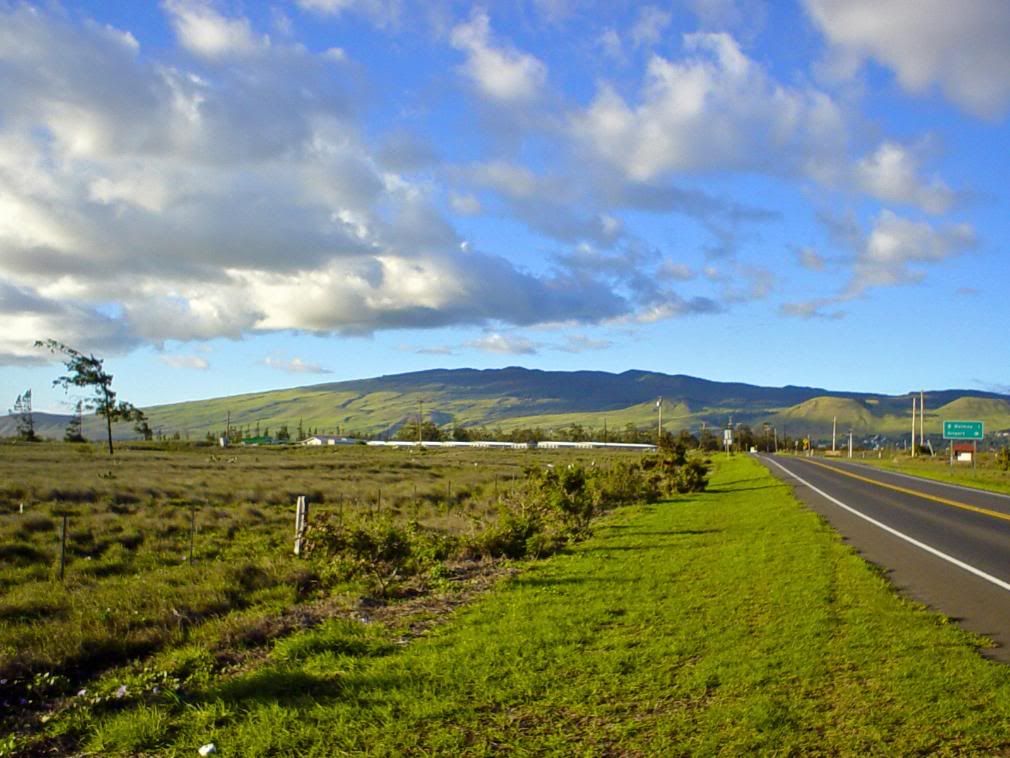 This image is looking north from an area in Parker Ranch. Mount Hualalai. It's on the west side of the island and reaches a height of 8,114 ft. It is considered dormant. It's last recorded eruption was in 1800-1801. This is the mountain behind Kona. They are not as safe from an eruption as they think they are. 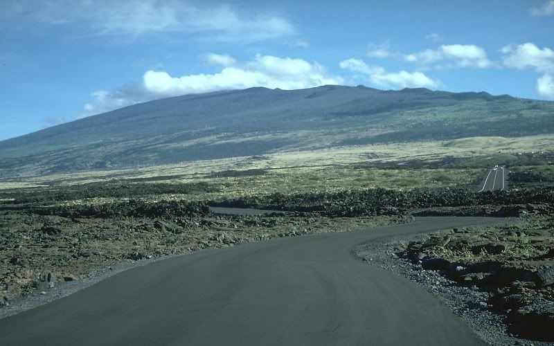 This is looking towards the east-south-east from the Kohala coast. Mauna Kea. It's name means white mountain because of it's Winters snow cap. It's 13,803 ft. tall and it's flanks reach down to 30,000 ft below sea level. It is considered by some to be the tallest mountain in the world. It makes up most of the center and northern east coast of the island. It's best known for the telescopes that reside near the summit. Mauna Kea is considered to be dormant. 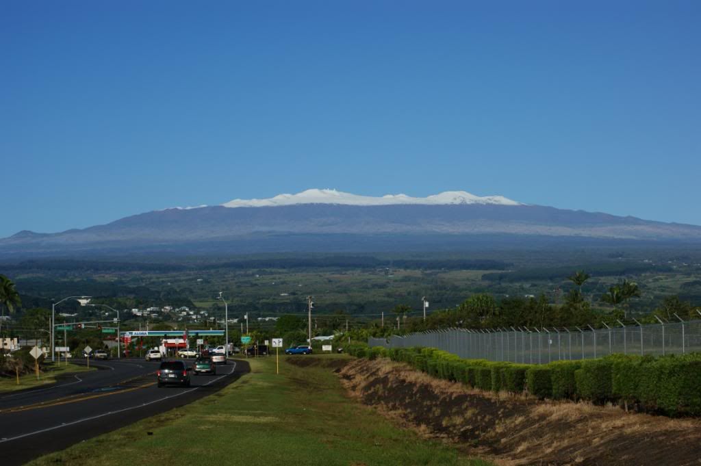 This is looking towards the north-west from Hilo International Airport. Next, is Mauna Loa, which means long mountain. It's height is 13,679 ft and it's the largest volcanic mountain in the world. It takes up over half of the land area of the island. The last eruption from Mauna Loa was in 1984, and the flow it created headed straight towards Hilo. It stopped!  There is a solar observatory on it's northern flank. 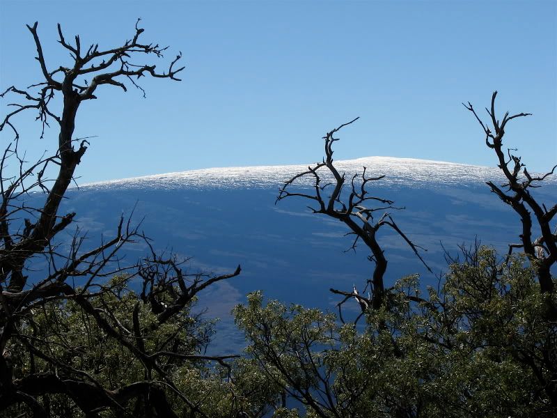 This is a view from the saddle between Mauna Kea and Mauna Loa and looks towards the south. Kilauea Caldera, the top of Mount Kilauea. Kilauea means much spreading. It reaches a height of 4,091 ft and is the most active, and visited, volcano in the world. Kilauea has been erupting since 1983 along the east rift zone at the *Pu'u 'O 'o/Kupaianaha vent, around 10 miles from Kilauea caldera. 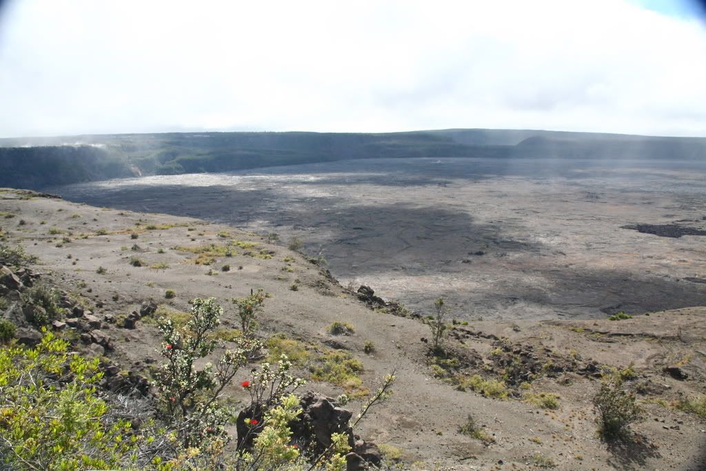 This is from the Kilauea look-out looking east. As always, I hope you enjoyed the ride. More tours: coming soon. Hopefully, from a more personal perspective. This is an island! ALOHA! *Pu'u O' o' means digging stick. |
|
|
|
Post by caucasoididiot on Apr 19, 2010 8:37:25 GMT -5
Great pictures! I like the contrast of the barren look around Mount Hualalai with some of the more lush scenery you've posted.
I seem to remember hearing that the underlying geology of the Hawai'ian chain comes from a large lava source under the pacific plate which periodically punches through it, leaving the string of islands as the plate continues to move. Do you know offhand if that's accurate?
|
|
|
|
Post by solgroupie on Apr 19, 2010 11:44:27 GMT -5
very nice pictures, chicken. i especially liked mauna loa and mauna kea. it really does go from one extreme to another there, doesn't it?
when you and spackle were talking about earthquakes it made me think of the one and only tremor i've ever experienced when i was a kid. my mom and dad and i were out on our screened in back porch when everything started rattling and we heard this low rumbling sound. it lasted for several seconds or so, and then all was still again. but that kind of thing almost never happens in tennessee. there was another one a few years back not too far from here. it freaks everyone out. i couldn't help laughing at your experience with that one back in '75. as if going to the dentist isn't stressful enough - having the receptionist screaming that you're going to die would have made me run out the door screaming.
|
|


 There is a solar observatory on it's northern flank.